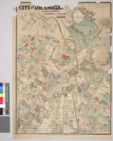
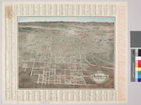
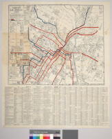
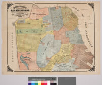
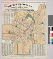
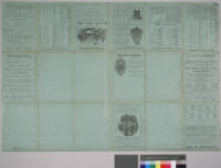
"Showing all streets and street car lines and sewer connections" "Index shows location of streets and shortest routes from centre of city" In lower left hand corner reads: "Compiled in office of Jas. T. Taylor"
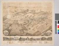
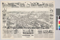
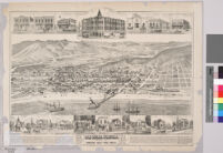
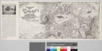
Perspective map not drawn to scale. Relief shown pictorially. Includes an index of important sites in the area. Directly above and below the view are insets of prominent buildings.
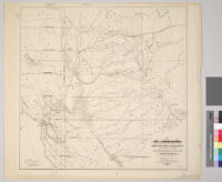
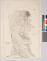
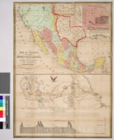
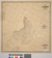
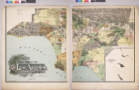
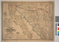
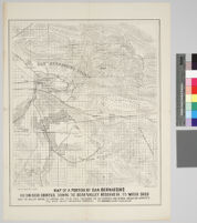
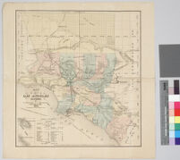
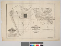
Relief shown by hachures. Shows drainage, township and section lines, land ownership, ranchos, settlements, railroads, etc. Los Angeles and San Pedro railroad shown as well as projected railroads from Los Angeles to San Berndardino, to Anaheim and from Compton to Anaheim.
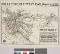
"A note of explanantion" on verso, outside when folded Insets: San Francisco-Monterey area -- Los Angeles & vicinity area Produced for the December 1956 Westways, v. 48 No. 12
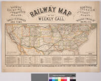
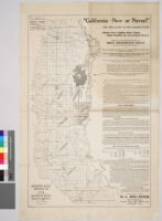
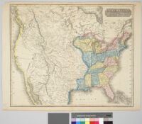
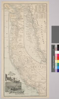
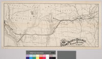
Map of the western United States showing relief by hachures, drainage, cities and towns, stage routes, railroads completed and projected. Main lines in heavy black. Verso of map includes trans-continental time tables, rates of fares, hotel and publisher's advertisements. Map originally folded to 22 x 16.3 cm.
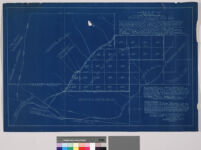
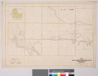
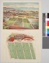
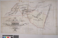
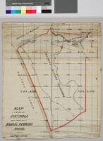
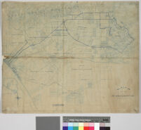
"Comprising 25,000 acres. The 40 acre tracts are square of 1320x1320 f. The 5 acre lots are 330x660 feet. The block of town lots are 270x620 feet. The two centre streets are 100 feet and all other streets are 80 feet wide. 40 acres reserved for College & Farm School"
![Map of the marked historical sites of California : compiled from the official registrations of the California State Department of Natural Resources [verso]](https://iiif.library.ucla.edu/iiif/2/ark%3A%2F21198%2Fz1k662qr/full/!200,200/0/default.jpg)
![Map of St. Louis and San Francisco R[ailwa]y and connections](https://iiif.library.ucla.edu/iiif/2/ark%3A%2F21198%2Fzz0015wtvz/full/!200,200/0/default.jpg)