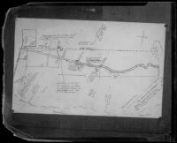
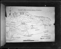
Photograph of a hand-drawn diagram that depicts Aimee Semple McPherson's account of her escape from her kidnappers in Sonora, Mexico. A dotted line, representing the U.S./Mexico border, extends across the upper third of the image. Below, the Sonoran town of Agua Prieta and its surroundings are depicted. Above the dotted line, Douglas, Arizona is represented. Notations and scale markers are also included in the diagram. A compass rose sits in the upper right corner. Signatures of witnesses Jackson Bergh and Mayor (of Agua Prieta) Ernesto Boubion are in the lower left corner.
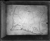
Possibly old plan of Los Angeles Plaza, the first one was commissioned in 1781. There have been many changes and other plans since then, and on this one there are annotations English while the majority is in Spanish.
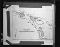
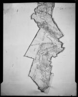
Diseno (design) map of a rancho land grant (Los Nietos grant) in Mexican California. This grant contained parts of modern day Los Angeles and Orange County. Map is in Spanish.
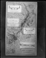
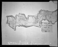
Copy of a map titled, Arroyo Seco Parkway. The map is produced by the Engineering Department, Automobile Club of Southern California and is dated Feb. 1936. William Neely's signature "W. Neely" sits in the lower right corner. The illustrated map shows the proposed Arroyo Seco Parkway connecting downtown Los Angeles to its northeastern communities. Four inset illustrations depict, from top to bottom: bridge elevation in South Pasadena, typical sections through Arroyo Seco, typical section through South Pasadena and viaduct.